Sanborn Maps
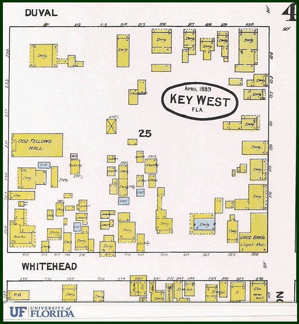
Sanborn Maps are often a good place to begin researching a historical building or site. Sanborn Maps began as fire insurance liability maps of U.S. cities and towns. They are an excellent historical resource to determine the age of a building, and, its foot, and its use.
Mapping for fire insurance purposes existed for a century prior to the emergence of the Sanborn Company, first beginning in London in the late 18th century. Sanborn printed its first insurance map in 1867 when it was founded by Daniel Alfred Sanborn, a surveyor from Somerville, Massachusetts. Within several decades they became the largest and most successful map company in the United States.
The maps contain an enormous amount of information including original decorative title page, an index of streets and addresses, a master index indicating the entirety of the mapped area and the sheet numbers for each large scaled map. They contain outlines of each building, the location of windows, doors, street names, property boundaries, building use, house and block number, composition of building materials and even the names of most nearby public buildings, churches and companies.
The volumes of maps are found primarily in archives and are invaluable for research into the evolution of specific buildings and sites. Sanborn Maps can be found in the research room at the Monroe County Library in Key West. A digital version can be found at the University of Florida, Map and Imagery Library.
Click here to visit the University of Florida Sanborn site.